
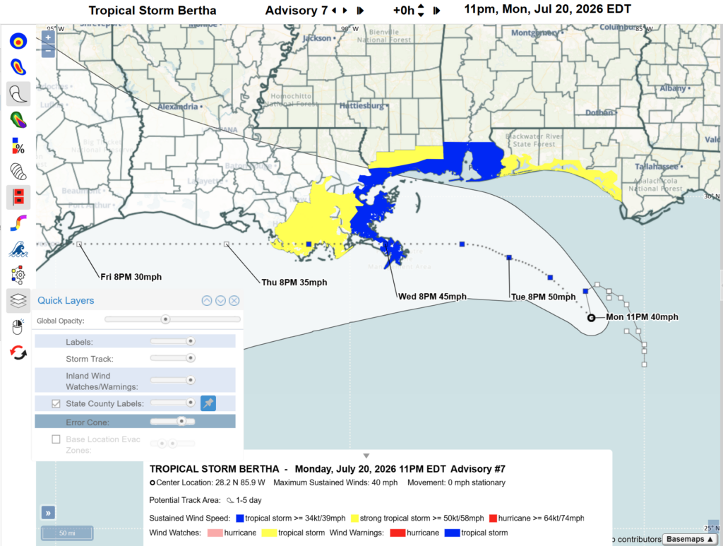
Inland tropical storm and hurricane watches and warnings are incorporated in HURREVAC to reflect changes to NHC’s operational cone graphic for the 2026 season.
This layer will be available for the continental United States, Hawaii, Puerto Rico and the U.S. Virgin Islands when wind watches and warnings are in effect.
To explore recent examples, load advisories from either Tropical Storm Arthur or Tropical Storm Bertha.
Click Watches and Warnings in the Storm Tools bar and select Inland Wind Watches/Warnings from the menu. These layers can be viewed individually, or in combination with Coastal Wind Watches/Warnings.
With watches and warnings displayed, then turn on the Potential Track Area (Error Cone) to replicate the NHC’s new cone graphic.
To learn more about this product and see additional examples, visit the Wind Watches and Warnings section of the HURREVAC User Guide.