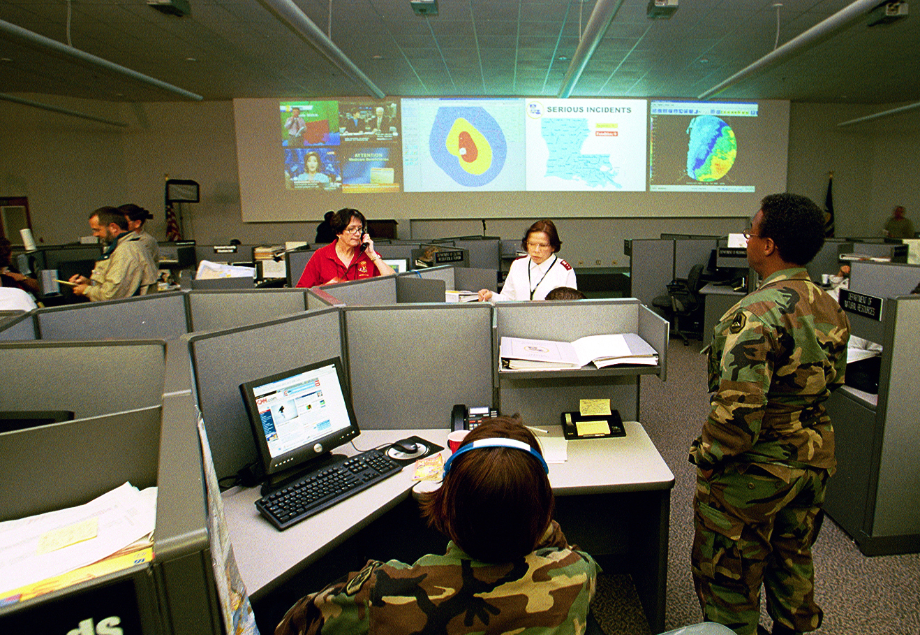
HURREVAC (short for Hurricane Evacuation) is a storm tracking and decision support tool. The software combines live feeds of tropical cyclone forecast information with data from various state Hurricane Evacuation Studies (HES) to assist the local emergency manager in making evacuation decisions based on the timing and potential severity of storm effects such as wind and storm surge.
Software access is restricted to officials in government emergency management. As a general rule, you are eligible to use the HURREVAC program if you are affiliated with:
Program access is distributed free-of-charge to eligible users who register here.
HURREVAC tracks hurricanes using the National Hurricane Center’s forecast advisories. The software translates forecast track and wind extent information from the NHC’s text-based products into interactive maps and reports that are used to chart the progress of an advancing storm. Storm surge (SLOSH) model output is made available within the program to assist with awareness of coastal areas vulnerable to seawater inundation. The program also assembles freshwater rainfall, flood, and river forecast information from various sources to assist users in evaluating inland flooding threats.
A critical feature of HURREVAC is its ability to keep to the local emergency manager apprised of how many hours or days a community has for preparation and planning in advance of a threatening storm. As new forecast information becomes available, HURREVAC continually updates and reports on the community’s Evacuation Start Time, or last possible time by which an evacuation could be initiated if it is to be completed before the arrival of the storm hazards.
The advantage of fine-tuning your evacuation start time in HURREVAC is that you can base decisions on the closest (and therefore most accurate) projections for the storm track, intensity, and size.
The decision to evacuate a community is not easy, and HURREVAC cannot make the decision for you. It is merely one tool that you may elect to use to help you in the decision-making process. Evacuation decisions are very complex and should only be made after consultation with all officials involved in the process, from NHC and the National Weather Service, to state and local emergency management officials.
HURREVAC calculates evacuation start time using inputs from the official NHC forecast and the Hurricane Evacuation Study for the county or parish of concern.
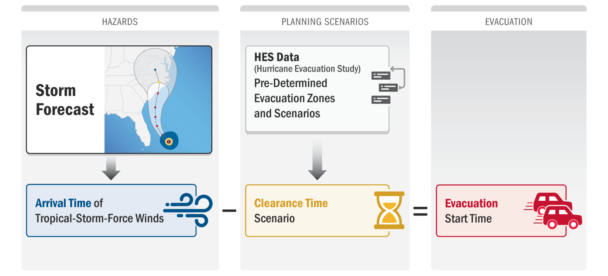
The NHC’s Arrival of Tropical-Storm-Force Winds product is used for determining how soon within a 5-day forecast period the hazards may begin in the jurisdiction. Two wind hazard start times are offered for the emergency manager’s consideration: a most likely time of onset and a more risk-averse earliest reasonable time of wind onset.
A clearance time scenario is selected by the emergency manager using guidance provided in the Hurricane Evacuation Studies (HES) documents for the region. This selection is typically guided by identifying which evacuation zones delineated in the HES process have potential for storm surge inundation given the present storm forecast. A number of other real-time factors (tourist population and public response, for example) may also influence the selection of a specific clearance time scenario.
Evacuation start time is reported as a range from earliest to latest, based on subtracting the number of hours in the clearance time scenario from the earliest reasonable and most likely hazard onset times.
This is off canvas menu widget area. To enable it add some widgets into Appearance – Widgets – Menu Section, and go to Customizer – Main menu to set the icon position.
Official HURREVAC program support site maintained by Sea Island Software, Inc., with funding from FEMA, the U.S. Army Corps of Engineers, and NOAA